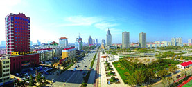
Digital technology reshapes urban life
Author : WANG DI Source : Chinese Social Sciences Today 2022-12-06
In the digital era, the development of urban public services has repeatedly made headlines in academic and social discussions, where conversations gravitate towards the “last mile” of smart city construction. This means the application of big data, cloud computing, smart terminals, blockchain, the mobile internet and other elements from the new generation of information technology to support community life in cities. It must be noted that the construction of a “smart community” is a multi-level, step-by-step, and systematic social undertaking, requiring unique and interconnected approaches to regional planning, facility operation and maintenance, and user services.
‘Internet of residence’
Modern cities are the culmination of the joint forces of regional planning, transportation networks, pace of life and other factors, and exhibit increasingly diverse and dynamic forms. With the advent of the digital age, information and data on urban operation have become abundant and easily obtainable. The range of electronic equipment deployed in cities creates a perfect digital environment, producing a rich, dense, and authentic information flow, and enabling urban operation to be simulated and projected in a digital setting.
Accordingly, urban functional area planning has gradually shifted from relying on survey data, remote imaging, and other traditional tools to utilizing dynamic resident behavior data such as traffic patterns and mobile phone signals. With the help of spatial resources such as the location of a site of interest, or an informative site, accurate identification and visualization can be carried out. POI, GIS technology, and spatial algorithms can be applied to provide new insights for urban planning and achieve general, or regional, intelligent and refined development.
As we move from general-scale urban planning to the community-scale of community blocks, we can also see that various technologies in the digital age are essential for guaranteeing provision of certain services. For example, accurate studies of residents’ daily lifestyle behavior based on big data, such as GPS positioning and GIS calculation, not only allows us to compare the difference between the travel choices and the shortest path between the functional units within a region, but also sheds light on residents’ demand for neighborhood support facilities, to appropriately plan residential or business areas.
Similarly, we can also measure the use of communal public spaces within neighborhoods according to the human flow data, measure the congested traffic distribution along vehicle flow paths, noting when and how long traffic jams are, and so on, to improve the layout based on the relationship between people and vehicles, green areas and functional zoning, thus clarifying the type, quantity, and utilization of public facilities.
The “internet of residence” can also be utilized to outline comprehensive portraits of different residential communities. Data such as housing types, prices and locations, available educational resources, population demographics and psychographics, and more, can be analyzed to assist with targeted community planning and design.
For concentrated communities of elderly citizens, communities with young children, and white-collar communities, reasonable adjustments of public service hours, the addition or reduction of certain public facilities, and flexible arrangements of public venues will effectively improve compatibility in community spatial planning and residents’ actual needs. By doing so, we can indirectly promote community residents’ sense of identity and stimulate their enthusiasm to interact and participate in public affairs. In the end, the prospect of residents participating in community collaborative governance will be greatly enhanced.
‘Internet of Things’
The applications and popularity of technology are accelerating in an exponential manner. At the same time, technologies in different stages—new and old—produce an accelerated force in the fusion, forming a “superposition effect” of application and diffusion. It is in this way that ICT technology expands from macro to micro and is eventually embedded in all kinds of urban components and material carriers.
At present, the “Internet of Things” constructed by various sensor devices, radio frequency identification technologies, satellite and wireless positioning technologies, and audio and video acquisition technologies, enable the real-time collection of tangible (such as garbage collection, vehicle parking) or intangible (such as air pollution, noise) data. The network linking physical entities and the perception, recognition, and management of a range of objects or phenomena is now a reality. As technology advances, the connection between things, things and people, and people and people, will only become faster and more complex in the future.
In terms of community services, we can develop the “web” of buildings and materials based on the intelligenization of internal equipment, facilities, and pipelines. Information from each subsystem can be collected by intelligent modules to complete intelligent centralized management and control, shorten the default response times, and perfect infrastructure monitoring, thus improving residents’ sense of security and comfort.
Specifically, we expect demands will be clear in advance (at least in real time) to realize intelligent anomaly perception and information collection. Traditionally, regular inspection and reports on construction, facilities, and lines are completed manually, and there are deficiencies in terms of operation efficiency, error control, and resource guarantees, as well as the risk that emergencies cannot be monitored in time.
With the support of modern community data systems, a real-time analysis of integrated network management data can be realized by monitoring various front-end sensor modules such as water, electricity, temperature, and gas, so that abnormal environmental indicators can be screened and detected in a timely manner. In addition, the development of technology makes it possible to map the changing curve of user demand, thus improving the efficiency of warehouse management. Therefore, not only can we scientifically store regular consumables, but we can also ensure the reasonable allocation and sufficient supply of daily necessities and emergency relief materials.
Under both normal and unexpected conditions, “Internet of Things” technology can comprehensively display the content, scale, quantity, geographical location, suggested actions, responsible personnel, and other information, to help the community governance system to accurately and quickly make plans. The efficiency and processing capacity of subsequent automatic or manual responses has been significantly improved.
For example, some street-level districts in Beijing’s Daxing District have implemented the real-name management of “one QR code per bike” for electric scooters, installed a “facial recognition” system for building elevators, and set up RFID wireless base station in corridors, to make sure electric vehicles cannot enter elevators and apartment buildings due to fire hazard.
Another example is the practice of Gulangyu Island in Xiamen, a popular tourist destination, where property services digitally check and register units such as houses, trees, and waste collection sites on the island. Each area has a grid, each facility has a QR code, each asset has an electronic file, each waste receptacle has a sensor, and each staff member has an ID, realizing the “connection between things and people.” When facilities are damaged or the waste is full, the system will automatically alert the maintenance personnel and sanitation workers. Meanwhile, the distribution of facilities and the division of labor can be adjusted reasonably through data analysis.
We can see in these examples that the “Internet of Things” enables efficient feedback, quick repair, replacement, or replenishment of materials. It is precisely because of such technological progress that some community properties confidently put forward the service principle of “2341,” which refers to responding to repair requests within 20 minutes, each standard order taking 30 minutes to address, for resource coordination to occur within 4 hours, and for solutions to major problems within 1 working day.
‘Internet of users’
The fundamental goal of technology’s development and application is to understand and respond to the needs of the people. When urban planning is accurate, and the monitoring and operation of facilities and equipment are effective, it is thus possible to serve the people in the city with personalized and refined services.
Changes in the method and speed of information acquisition have enabled relevant organizations to acquire personal data and household data on the premise of protecting people’s right to knowledge and privacy, forming an important “internet of users” and reshaping the communication channels and methods between governments, enterprises, and individuals.
For one thing, the smooth flow of data can reduce the workload and information pressure on the government and on enterprises, theoretically improving the work efficiency and service quality, while avoiding information gaps and data “islands” caused by divisions among departments. It can also empower residents to meet their own needs and engage in public affairs, thus enhancing public trust in several organizations in an ideal state. For example, community grid management allows data collected in code and by facial scanning to be used in a unified manner in terms of matching public facilities, coupled with online and offline feedback, to comprehensively optimize community governance.
Furthermore, data analysis using artificial intelligence can also reveal actionable information hidden within huge volumes of data, such as the unexpressed needs of residents, so as to help various organizations predict potential service vectors. Using the information expressed via of users’ terminal devices and feedback from facilities and equipment in public spaces, including smart phones, smart medical devices, cameras, electronic wearable devices, and other sensing devices, we can accurately analyze and predict service demands. For example, health monitoring data or motion data from the elderly population in the community can help detect and prevent risks, which plays a dynamic and humane role in constructing an elderly-friendly neighborhood.
In the digital era, urban community life depends heavily on big data, from planning to governance. Due to its decentralized, immutable, and confidential nature, blockchain technology can generate massive, dynamic, accurate, and authentic data that allows urban communities to be better constructed and maintained. It also makes it possible to connect and reconstruct community relations.
However, we must bear in mind that a community is a community of people, and the development and utilization of technology should always strive to serve the people and improve governance, not for surveillance and confinement. On the basis of understanding and serving people, all kinds of digital technologies should be put into better use for facilitating participation, meeting people’s needs, and providing optimal ways for urban community construction, co-governance, and sharing, thus enhancing the efficiency of social governance.
Wang Di is from the School of Sociology at Peking University.
Ye Shengtao made Chinese fairy tales from a wilderness
Ye Shengtao (1894–1988) created the first collection of fairy tales in the history of Chinese children’s literature...
-
How northern ethnicities integrated into Chinese nation
2023-09-18
-
Mogao caves
2023-09-12
-
Mogao Grottoes as ‘a place of pilgrimage’
2023-09-12
-
Time-honored architectural traditions in China
2023-08-29
-
Disentangling the civilizational evolution of China
2023-08-28
-
AI ethics in science fiction
2023-08-23


 2011-2013 by www.cssn.cn. All Rights Reserved