

Interdisciplinary research shapes historical urban geography in China
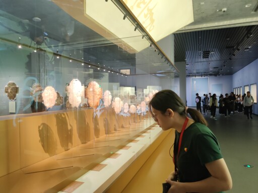
Visitors view exhibitions at the Yinxu Museum in Anyang, Henan Province. Photo: Fang Ke/CSST
Historical urban geography, as a discipline studying the spatial structure and morphological evolution of cities during historical periods, emerged in the 1950s in response to national economic development needs. China’s historical urban geography started with research on cities such as Beijing, Xi’an, and Chengde, and rapidly developed with the support of disciplines like history, geography, archaeology, and urban planning. At the end of the 20th century, the deepening of cultural and urban studies, together with the introduction of sociological theories and technologies such as Geographic Information Systems (GIS), further propelled the field. This not only enriched the theoretical framework of historical urban geography but also provided diverse perspectives and research methods for a deeper understanding of cities as complex socio-geographical phenomena. Across different stages, archaeology, sociology, and GIS each played a key role in shaping the discipline’s development.
Social structure and urban space
Cities, as densely populated fields in which social issues frequently concentrate, have long been a core object of sociological inquiry. By analyzing urban residents’ social needs, behavioral patterns, and changes in social structure, sociology offers a social perspective for understanding the dynamic development of cities. These social factors not only shape the lifestyles of urban residents but also profoundly influence the spatial layout and morphological evolution of urban space. In particular, the distribution of different social strata and groups has become a key concern of sociological inquiry. In many ancient Chinese cities, aristocrats and wealthy merchants tended to occupy the central areas, enjoying superior living environments and resources, while ordinary residents largely relegated to the urban periphery. This residential distribution pattern not only reflected the social hierarchy of the time but also exerted a lasting influence on urban spatial structure and functional organization.
Historical urban geography, by contrast, attempts to reveal the geographical spatial dimensions of urban development by examining changes in spatial structure and form across different historical periods. It focuses on processes such as the expansion of urban boundaries, the evolution of functional zones, and the reorganization of internal spatial structures, providing an essential basis for understanding the historical trajectories and evolutionary patterns of urban development.
For example, the Record of Chang’an City, compiled by Northern Song (960–1127) historian Song Minqiu, documents the urban layout and residential distribution of Chang’an during the Tang Dynasty (618–907), highlighting the city’s rigorously planned and orderly spatial structure. The palace city and the imperial city, which housed the emperor and central government offices, constituted the urban core. Surrounding this core, the outer city functioned as both a commercial and residential area. Because aristocrats and high-ranking officials primarily resided in the eastern districts close to the palace and imperial city, while merchants and other residents clustered around the West Market, a spatial pattern known as “the aristocracy in the east and wealth in the west” gradually took shape. This case illustrates how applying sociological theories and methods to the study of historical urban social structures can yield deeper insight into the evolution and characteristics of urban spatial organization.
Archaeological discoveries and urban origins
Archaeology and historical urban geography are closely related disciplines. Archaeology is dedicated to uncovering and analyzing ancient relics and artifacts to reveal the development processes and cultural characteristics of cities, providing indispensable material support for studying the interrelationships among cities, natural environments, socio-economic conditions, and human activities during historical periods.
The Yinxu, or the Yin Ruins, in Anyang, Henan Province, offers a representative example. As the capital of the late period of the Shang Dynasty (1600 BCE–1046 BCE) and one of the earliest known national political centers in Chinese history, Yinxu has yielded abundant archaeological remains. Excavations have uncovered extensive palace architectural remains with rigorous layouts and clearly defined functional zones, including structures used for political activity and auxiliary residential buildings, reflecting the high degree of organization and hierarchy in Shang society. Large numbers of bronze artifacts, notable for their exquisite craftsmanship and variety, have also been unearthed. These artifacts are not only crucial for the study of bronze casting techniques, social rituals, and religious beliefs during the Shang Dynasty but also signify the prosperity of urban economies at the time.
In the course of excavation and research on Yinxu, historical urban geography has, through its distinctive perspectives and methods, provided important supplementation and further depth to archaeological research. By conducting detailed analysis of the site’s spatial layout, historical urban geography has revealed the distribution of, and relationships among, functional areas such as the palace zone, burial zone, and handicraft workshop zone. This not only helps archaeologists better understand the functional zoning and spatial structure of Shang cities but also offers a theoretical framework for interpreting patterns of daily life, economic activity, and social organization among urban residents at the time.
Historical urban geography also focuses on the development and evolution of cities. Through comprehensive investigations of the geographical environment and historical background of Yinu and its surrounding areas, it explores the rise, development, and interactions between cities and their surroundings during the Shang Dynasty, providing archaeologists with historical context and background information about urban evolution. In addition, the discipline plays an important role in the protection and planning of archaeological sites by assessing spatial characteristics, environmental factors, and potential threats, thereby supporting the formulation of scientific and rational conservation strategies. This form of interdisciplinary collaboration and exchange has promoted the mutual development of archaeology and historical urban geography, contributing to a more comprehensive understanding of Yinxu and of ancient urban civilization more broadly, as well as its cultural significance, while also showcasing the distinctive appeal and scholarly value of both disciplines in exploring ancient urban civilizations.
GIS and urban analysis
With its powerful capacity for spatial data processing, GIS offers historical urban geographers unprecedented research perspectives and depth. Notably, the China Historical Geographic Information System (CHGIS), jointly developed by the Center for Historical Geography at Fudan University and Harvard University, marks the formal application of GIS technology in Chinese historical geography—providing scholars with unprecedented technical capabilities and triggering a shift in research paradigms.
The CHGIS project exemplifies the comprehensive application of GIS within historical urban geography. By establishing precise historical geographical spatial frameworks, it enables researchers to more precisely locate and analyze urban spaces during historical periods. Researchers can—by overlaying topographic maps, satellite imagery, and historical maps—visually observe urban boundaries, street layouts, and architectural distributions across different eras, making it possible to trace changes in urban spatial patterns over time. This meticulous spatial analysis not only aids in better understanding the formation and development processes of historical cities but also offers valuable references for modern urban planning.
At the same time, GIS technology has made interdisciplinary research in historical urban geography more feasible and systematic. By integrating GIS technology with knowledge and methods drawn from history, sociology, economics, and other disciplines, scholars are able to conduct more in-depth and comprehensive studies. For example, combining GIS with economic history data allows analysis of the spatial distribution and evolution of economic activities in historical cities; integrating social history data enables exploration of urban social structures and mobility patterns during historical periods. This interdisciplinary research approach not only enriches the theoretical framework of historical urban geography but also provides possibilities for comprehensively understanding the complexity of urban development.
Additionally, GIS technology offers crucial support for historical archaeology and urban heritage conservation. With GIS technology, archaeologists are able to accurately determine potential site locations and plan excavation areas, thereby avoiding disorderly destruction of heritage sites. GIS can also be used to construct three-dimensional models of heritage sites and to simulate the impacts of environmental and climatic change, providing a scientific basis for formulating effective conservation measures. The application of this technology not only helps protect historical and cultural heritage but also offers a more reliable foundation for future archaeological excavations and research.
The interdisciplinary application of GIS technology within historical urban geography has thus opened up new perspectives for examining and understanding historical cities. Through specific case studies, it is possible to see the immense potential and value of GIS technology in the spatial analysis of historical cities.
Nevertheless, GIS applications continue to face certain challenges and limitations. The acquisition and organization of historical geographic data, for example, is a massive and complex undertaking that requires substantial investments of time, labor, and resources. In addition, the results of GIS-based analysis are constrained by data quality and processing methods, making careful verification and interpretation by researchers essential. Even so, ongoing technological advances and the continued expansion of application fields give reason to believe that GIS technology will inject further vitality and momentum into the future research and development of historical urban geography.
In addition to the interdisciplinary influences discussed earlier, fields such as philosophy, economics, ecology, and remote-sensing technologies have also had a profound impact on historical urban geography, breathing new life into the field through the adoption of interdisciplinary research approaches. Looking ahead, continued interdisciplinary convergence is likely to offer richer theories, more varied research methods, and broader perspectives, further promoting the sustained development of historical urban geography.
Zhang Manyun and Zhang Xiaohong (professor) are from the Center for Historical Geography at Fudan University.
Editor:Yu Hui
Copyright©2023 CSSN All Rights Reserved