

New technology aids in ancient maps studies
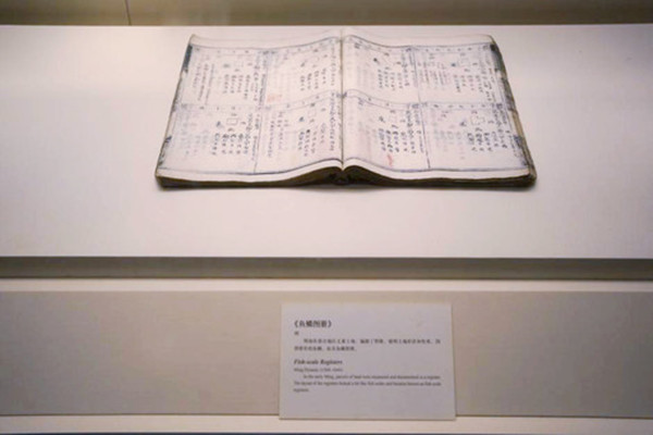
Yulin tuce [fish-scale map registers] from the Ming Dynasty on display at the National Museum of China in Beijing Photo: Yang Lanlan/CSST
In early June, a symposium on cartographic research took place in Beijing. Attendees exchanged views on various themes, including “Map Theory and New Vision,” “Map Literature and Geographic Information,” and “Map Compilation and Technology History.”
Multi-dimensional value
While visually expressing geographical space, maps also contain temporal elements. Wang Qianjin, director of the Institute of Maps at the National Museum of China (NMC), pointed out that the analysis of temporal concepts, types, and systems helps further the study of physical geography, human geography, and geographical concepts of ancient maps. Temporal analysis also offers clues for identifying techniques pertinent to the surveying, mapping, publication, and dissemination of ancient maps, and deepens our understanding of how the ancients perceived and expressed geographical information.
Li Xiaocong, a professor from the Department of History at Peking University, highlighted the necessity of matching ancient maps with descriptions in textual records or archives, especially the various thematic maps drawn in the Ming (1368–1644) and Qing (1644–1911) dynasties, restoring the relationship between maps and texts. Additionally, this alignment lays the groundwork for investigating times, places, characters, and deeds inherent in ancient maps. He further called for more efforts to interpret the methods used in ancient map drawing and surveying, suggesting that theoretical approaches from intellectual history, art history, and image history be employed to better understand these maps.
Ancient maps of the Yellow River are of great academic value. As the core focus of dynastic courts on river governance, the Yellow River became an essential component in historical documents and traditional maps. Currently, over 1,000 ancient maps of the Yellow River are housed in various institutions both within China and abroad, including the National Library of China. These maps provide valuable documentation for research on the development, governance, and ecological conservation of the Yellow River basin.
According to Hua Linfu, a professor from the Institute of Qing History at Renmin University of China (RUC), the library of the Institute of Geographic Sciences and Natural Resources Research at the Chinese Academy of Sciences is in possession of a well-preserved long-scroll ancient map of the Yellow River. This map, for which no other versions are known, offers a detailed depiction of the lower reaches of the Yellow River, and thus can be used to reconstruct river governance practices in the early Qing Dynasty and understand the relationship between the Yellow River, Huai River, and the Grand Canal.
Digital tools
The digitization of ancient maps can effectively verify the methods used by ancient Chinese cartographers. In recent years, scholars have generally agreed that ancient Chinese mapmakers based their work on the relative positions of landmarks and geographical features. However, this view lacks credible evidence and reliable verification methods. Sun Jingguo, director of the Historical Geography Research Office at the Institute of Ancient History affiliated with the Chinese Academy of Social Sciences, used GIS and Python to analyze the eight types of 28 maps of Xuanfu Military Town from the Ming Dynasty. Their research found that the relative positions of the forts on these maps closely matched their actual locations, indicating that the central court and the town office were very familiar with the geography of these forts.
The presentation of these maps demonstrates a correlation between the fort system and their relative positions, reflecting the method used to create coordinate systems based on the relative positions of geographical features. Instances where the positions were less accurate were primarily due to geographical factors and layout constraints, Sun explained.
At present, scholarly discussions on transportation routes in ancient maps mainly focus on the selection of traffic nodes, with limited research on the quantification and analysis of specific traffic routes. NMC scholar Jiang Wan suggests that the shortest path analysis module in ArcGIS software, combined with the function of the relationship between human walking speed and slope, can be used to construct models of ancient transportation routes based on digital elevation model data.
“Combining this method and historical documents together with the analysis of passing time, we can obtain the calculable relation function between ancient traffic routes and time loss,” Jiang continued. This method can provide more precise and quantitative data reference for cultural, political, and military communication routes in history.
The conference was co-organized by the Institute of Research at NMC, as well as the Institute of Qing History and the Research Center of Historical Geography at RUC.
Editor:Yu Hui
Copyright©2023 CSSN All Rights Reserved